“An energy site is not a static asset map; it is a living point of ecological pulse.”
Imagine two energy sites under nearly the same sky. They have similar capacity, sit in the same climate band, and operate under similar commercial pressure. At one site, management is defined by routine alone: mowing schedules, cleared edges, orderly surfaces, predictable maintenance. At the other, the land is tracked through ecological signals as well as operational ones. Vegetation continuity is checked across the season. Flowering gaps are noted. Pollinator movement is observed. Areas under repeated maintenance pressure are mapped instead of being treated as background. After a few years, the difference does not stay in the landscape. It appears in ESG reporting, in permitting conversations, in stakeholder scrutiny, and in how credible a company sounds when it speaks about stewardship. An energy site is not a static asset map; it is a living point of ecological pulse.
Measuring Ecological Pulse
Biodiversity monitoring in energy landscapes often begins with the wrong endpoint. A species list matters, but it rarely explains whether the site is functioning as habitat. The more useful question is whether ecological functions are holding over time. Are flowering resources continuous enough to support insect activity across the season? Does bare soil persist after maintenance? Does a mowing regime interrupt recovery just as vegetation begins to stabilize? Are pollinators simply passing through, or are they repeatedly using the site as part of a seasonal route? Once these questions enter the frame, monitoring becomes less about counting presence and more about testing whether life can persist.
The key is to track function, not just appearance. Habitat quality indicators help do that. Plant diversity, flowering continuity, ground cover, and maintenance pressure can be read together to show how livable a site actually is for other forms of life. A single observation does not capture that condition. Time-series monitoring does. The same indicators are measured at fixed intervals—typically spring peak growth, late summer stress, and autumn recovery—so temporary greening can be separated from sustained ecological improvement. In operational terms, this works as a site-level indicator set: every quarter, vegetation continuity, pollinator activity, and maintenance intensity are reviewed in the same reporting format.
This logic aligns with the broader policy direction in Turkey, where the 2024–2030 Climate Change Adaptation Strategy and Action Plan strengthens the link between climate adaptation and ecosystem-based approaches. For companies managing solar and wind assets, that matters because environmental performance is no longer judged only through output and compliance. It is also judged through how the site interacts with surrounding ecological systems. When habitat improvement measures are tied to annual ESG indicators, biodiversity monitoring moves out of the realm of vague commitment. It becomes part of how site quality is evidenced and compared.
Reading Field Signals with Remote Sensing
Looking only from the ground is not enough. Looking only from above is not enough either. Remote sensing provides regular, large-scale visibility; field biology explains what those patterns actually mean. NDVI, for example, is a vegetation index derived from satellite imagery. It tracks how green and dense plant cover appears over time, making it easier to see which parts of a site remain stable, which decline mid-season, and which recover after disturbance. That is useful across solar fields, wind sites, and industrial footprints. But greener does not automatically mean better habitat.
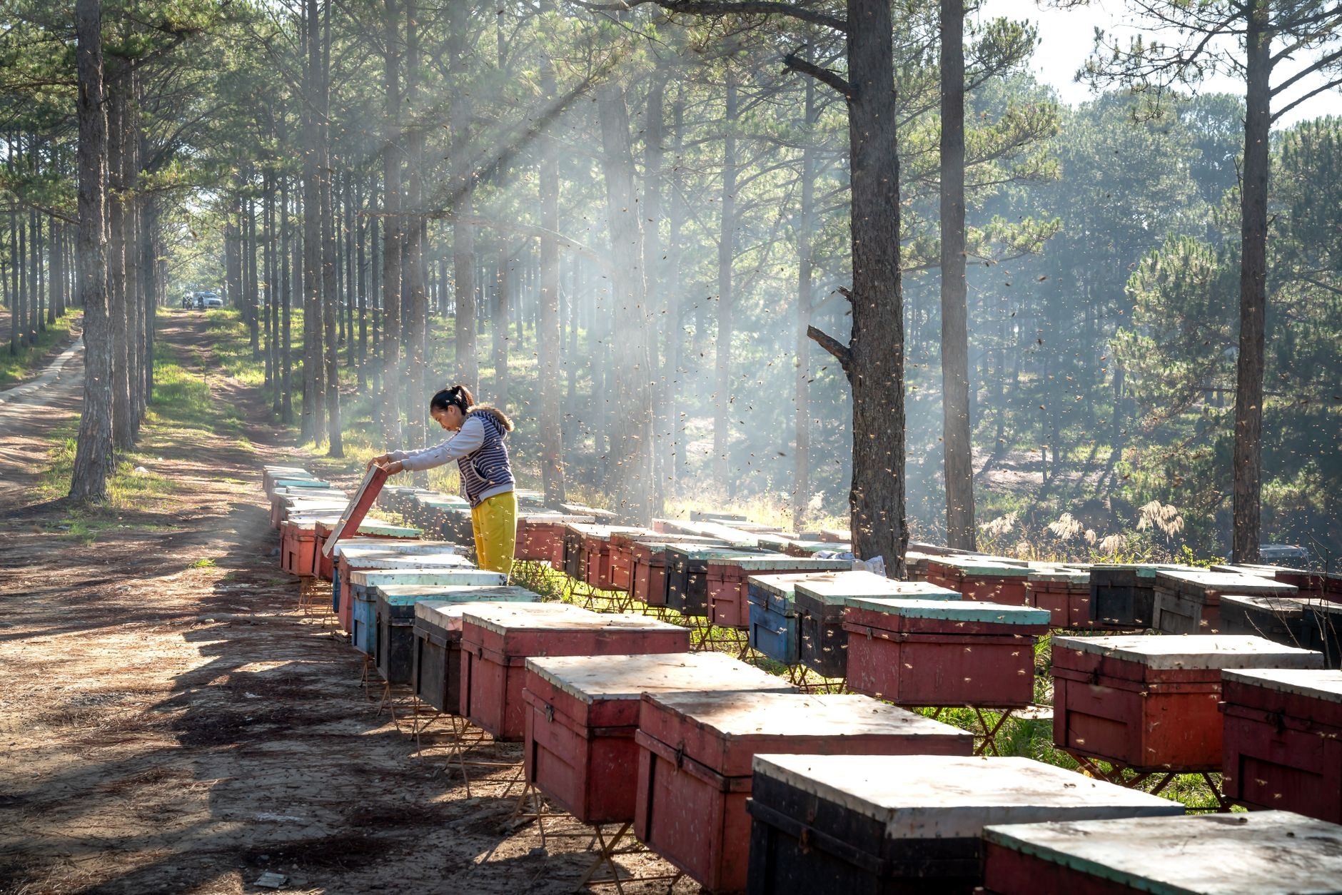
This is where pollinator activity monitoring becomes essential. Flight intensity, visitation behavior, and hive-related signals help show whether bees and other pollinators are actively using the site. Satellite data describes the vegetation pattern; biological data tests whether that pattern supports ecological activity. Andromedy, through its PolliNex and Motesari projects, brings bee behavior, in-hive sensor data, and satellite indices into the same monitoring frame so habitat quality and biological activity can be read together. The value lies not in the tools themselves, but in turning scattered signals into a shared basis for interpretation.
No single layer of data tells the whole story. In solar sites, vegetation under panels and between rows follows different moisture, shade, and access dynamics. In wind sites, habitat continuity is often shaped by turbine surroundings, service roads, and mowing frequency. In industrial sites, the most important ecological signal may sit at the edges, where fragmented strips of habitat carry more biological function than the core surface suggests. The indicators can remain consistent, but interpretation must stay asset-specific. In practice, one clear method is to compare the same zones before and after a maintenance regime change across three seasons, then review how vegetation continuity and pollinator movement shift together.
Building a Comparable Impact Language
Energy infrastructure is managed through comparison. Output is compared, downtime is compared, maintenance efficiency is compared. Ecological performance needs the same discipline. Turkey’s Official Statistics Programme 2022–2026 emphasizes measurability and comparability in energy indicators; the same principle applies to biodiversity. Ecological performance that is not monitored cannot shape decisions, and ecological performance that cannot be compared rarely survives budget or reporting pressure.
That is why reporting format matters as much as field method. For decision-makers, useful biodiversity monitoring does not arrive as scattered observations. It arrives as structured outputs: seasonal scorecards by site, annual trend graphs, before-and-after comparisons tied to maintenance changes, and portfolio-level maps showing risk and recovery patterns. That structure allows a company to see where a solar site is gaining vegetation cover but losing pollinator activity, where a wind site is fragmenting habitat through access pressure, and where an industrial edge zone is carrying more ecological value than expected. In environmental impact assessment, sustainability reporting, and stakeholder communication, this creates evidence that is time-based rather than declarative.
Turkey’s Sixth National Communication on Climate Change reinforces this wider perspective by linking energy, land use, and environmental pressure at the national scale. That matters because energy infrastructure can no longer be assessed through carbon alone. Habitat fragmentation, seasonal recovery, and biological movement also belong in the picture. Biodiversity monitoring therefore stops being an ornamental layer in corporate communication and becomes part of operational quality, risk reduction, and permitting credibility. The difficult question is no longer whether a site looks greener on paper. It is whether the company can show, season after season, that the landscape around its infrastructure is actually becoming more capable of holding life.